
An Alabama state county map displays the counties of Alabama, illustrating their borders. Such map is a great resource for residents, travelers, and researchers alike, providing insights into the layout of Alabama’s varied regions.
Knowing the counties is a must for things like navigation, property research, and local governance. Let’s dive into the details and applications of Alabama’s county maps in the sections below.
Overview
Name: Alabama
Short Description: Alabama is a southeastern U.S. state known for its role in the American Civil Rights Movement, rich cultural history, and diverse geography ranging from mountain ranges in the north to Gulf Coast beaches in the south.
Capital: Montgomery
Population: Approximately 5.1 million (2024 estimate)
Area: 52,420 square miles (135,767 km²)
Nickname: The Yellowhammer State
Motto: "Audemus jura nostra defendere" (We Dare Defend Our Rights)
Statehood: December 14, 1819 (22nd state)
Major Cities: Birmingham, Huntsville, Mobile, Montgomery, Tuscaloosa
Time Zone: Central Time Zone (CT)
Geographic Features: Appalachian Mountains, Black Belt prairie, Gulf Coast shoreline, Mobile Bay
Major Industries: Aerospace, steel production, auto manufacturing, banking, agriculture (cotton, peanuts, poultry)
Famous For: NASA’s Marshall Space Flight Center, Rosa Parks & Montgomery Bus Boycott, college football (Alabama Crimson Tide)
Blank map of Alabama County
![]()
Decoding the Alabama County Map
Making sense of the Alabama county map reveals 67 counties, each with its county seat, illustrating the area’s divisions. This critical asset helps locals, visitors, and academics understand the state’s population, history, and infrastructure, especially regarding new counties and county creation.
County Lines
County lines are really important in delineating jurisdiction. Each line denotes where one county stops and another starts, in order to prevent mix-ups in administration. Technically, we should care to understand these lines because they determine what local services you receive — law enforcement, public education, etc.
County lines have a long history, having been established for a number of reasons – from geographical to population – which makes them especially meaningful in contemporary times.
Key Cities
Important cities or county seats underlined on the map, like Birmingham in Jefferson County or Montgomery in Montgomery County, are critical for urban planning and navigation. These population centers tend to be where the economic activity is, which means they’re critical for travel and logistics.
Using city markers, plan your business routes and tourist routes. The proximity of these cities to nearby counties gives you a little more insight into regional dynamics, especially commerce and resource sharing.
Topography
Alabama’s topographical features expose some major landscape differences. The map’s contour lines reflect elevation changes, crucial for deciphering steepness of terrain. These are features that affect farming and weather patterns, and consequently, how the land was used.
Striking landforms, like the Appalachian Mountains in the northeast, have been pivotal in both conservation and urban planning, influencing how we relate to the natural landscape.
Waterways
Alabama’s waters such as the Alabama River and a number of lakes are important natural resources. They nurture local eco-systems and increase biodiversity – helping to keep things in perfect ecological balance.
The map helps uncover recreational opportunities along these streams, encouraging tourism in the area. Equally as important is our awareness of flood zones when managing water, and this map provides the data we need to plan effective flood prevention.
Transportation
Roads are an important component of the map. Interstate highways and roads provide convenient access, and bus routes make it easy to get around town for the local people.
Interconnectivity between transportation networks not only facilitates trade, but it fosters economic development, which is why it has been an area of emphasis for planners. It shows the effect of infrastructure on migration and commerce, illustrating the connection between transportation and affluence.
The Map's Evolving Story
Decoding the Alabama state county map necessitates a glance into its history, boundary wars, and contemporary transformations. Each layer reflects the creation of new counties, illustrating how settlers, politics, and geography have become enmeshed over time.
Historical Shifts
Major events in Alabama’s county formation significantly shaped its development. The early 19th century brought an end to boundary disputes, especially when Georgia ceded its western lands to the federal government in 1802. This was a crucial step in resolving the Yazoo land deals and establishing new counties in the area.
Migrations were central to county creation as well. As American settlers moved in, they built communities that corresponded to their needs, leading to the establishment of counties. The geography of Alabama, with its rivers and mountains, influenced these patterns of settlement.
Take, for instance, the eastern border of West Florida along the Chattahoochee River. Important legislation and treaties, such as the 1765 agreement between the British and the Choctaws, changed county lines over the years, often carving out territory that was frequently disputed.
They had established the 35th parallel as a border in 1735, which set the stage for control changes and the creation of populous counties as the region developed.
Boundary Disputes
Boundary disputes have long characterized local politics. There were notable disputes between Alabama and its neighbors. For example, the Alabama-Georgia boundary commission redesigned the 1826 “Nickajack line.” This tweak moved the border some 40 miles further north, exemplifying the way in which politics informs maps.
Legal decisions in these fights have hung in the balance. Courts have decided on disputes, establishing our present set of boundaries impacting community dynamics. Such conflicts occasionally test neighborly relations, as conflicting interests arise along these lines.
The Alabama-Mississippi boundary dispute, along with other local government case studies, illustrates that these battles are, in many ways, about something more profound — identity and community.
Modern Changes
Recent lines, in turn, reflect changes to county boundaries due to population shifts and urbanization. As cities grow and counties shift to house new populations, the map changes. Cities emerged as epicenters of administration for counties.
Technological innovations improve map precision. GIS can be used to create fine-scale maps that make it easier for governments to cope with shifting populations and land use. Public feedback is integral to these new maps.
A Map of Alabama's People
Exploring these different aspects can provide a more complete picture of what it means to be a map of Alabama’s people, including the creation of new counties and the impact of treaties with native Americans.
Population Density
Mapping Alabama’s population shows concentration in the urbanized areas of Birmingham, Montgomery and Mobile. Beyond that, it points to an ongoing population shift towards urban areas, which implies more demand for urban services and infrastructure.
Density has a huge effect on service delivery. These are just examples—high-density areas might demand more robust public transportation, health services and schools. Rural areas often have difficulty delivering these services.
Density information is vital to urban planning and zoning. Planners can use this to know where to put resources efficiently, directing new developments to where the need grows.
By looking at these patterns of population movement, we can stay ahead of where people will need services next. Take, for example, a county that is inundated with new residents—more homes, schools and jobs are necessary.
Economic Hubs
Alabama’s economic hubs are Jefferson County, Mobile, and Huntsville. These regions play an important role in the state’s economy, delivering thousands of jobs and economic growth.
The dominant sectors of these hubs—like aerospace, manufacturing, and healthcare—present diverse investment prospects. Knowing which industries are booming can provide direction for prospective investors and companies seeking to set up shop in Alabama.
Economic hubs are tied to transportation. Access to interstates and railroads serves commercial and residential mobility, thus making these areas more desirable to employers and employees.
Economic activity impacts local demographics and culture. Communities with a heavy manufacturing focus might draw a wide range of workers, influencing the cultural and social makeup of the area.
Cultural Regions
Charting Alabama’s cultural regions, Part I Every region is home to distinctive traditions, foods and art. Geography is very important to culture. The coast, for example, boasts seafood festivals and the mountains may have their own style of music.
Mardi Gras in Mobile or the National Shrimp Festival in Gulf Shores are examples of festivals that highlight the culture of certain regions, drawing in local folk as well as visitors.
Cultural regions affect tourism and local economies as well. By marketing culture, communities can increase their economic viability through festivals and attractions that highlight their uniqueness.
Beyond the Boundaries
Knowing the Alabama state county map reveals important details about the state’s resources, land use, and political landscape. This map illustrates how new counties are interconnected and how everything relates to the different areas within the territory.
Natural Resources
Alabama was blessed with natural resources, including abundant deposits of minerals such as coal, iron ore and limestone. It boasts the state’s largest forests and most water, including the Alabama River and Lake Guntersville. They back local economies and create tens of thousands of jobs.
The resource allocation impacts local economies. For example, places where there’s a lot of timber you have the lumber industry, and if you have mineral deposits, you’ve got mining industries.
On the flip side, resource extraction can cause local environmental issues, like habitat destruction or water contamination. Conservation is key, preserving Alabama’s natural treasures while maintaining economic growth.
Land Use
- Urban expansion
- Agricultural land conversion
- Industrial development
- Conservation areas
Zoning and other planning laws have a substantial impact on land use and development throughout Alabama. These laws determine how land may be used, either residential, commercial, or agricultural.
Land use patterns have changed over time, with cities encroaching on the countryside. This success creates its own problems, such as congestion and pollution, which require thoughtful urban policies to address.
Land use decisions affect environmental sustainability as well. For instance, farmland recycled for urban use typically decreases the amount of land in food production, which poses a threat to food security.
Political Districts
I map districts in Alabama. These districts determine how people are represented in government and can influence election results. The borders of these districts can affect voting, grouping communities with shared interests or splitting them up in ways that lessen their impact.
The overlap of political districts and community interests is seldom straightforward. Communities in the same district might have conflicting interests, which makes rule problematic.
Redistricting, which can be an explosive issue, in fact can change the local power structure and governing.
Using the Alabama Map
Here’s how to use the Alabama map for educational projects, community planning, or just exploring the territory, as digital and physical maps are crucial for understanding counties.
Digital Tools
Online mapping services can be wonderful for anybody requiring live information. For example, both Google Maps and MapQuest enable you to see traffic, closures, and even satellite images. These aren’t just navigation tools – they augment presentations and project analysis with interactive features.
GIS goes even further, enabling sophisticated spatial analysis and visualization of data. Using GIS, you can look at demographic or environmental trends in individual counties. This is especially helpful in domains such as urban planning or public health.
Mobile apps round out these tools providing handy navigation and location tracking. Apps like Waze and Citymapper will drive you the fastest route or public transit. For schools, too, there are some fantastic apps that get students out and mapping, raising community consciousness and involvement.
Physical Maps
Printed maps are still around for the old fashioned uses. They play a critical role in regions that might not have immediate digital access, like remote parts of Alabama. Physical maps are great to use in the classroom, sparking discussions about geography and local history.
There’s something more concrete about having a map in your hand that helps students visualize and get a feel for their surroundings. Furthermore, paper maps shine in situations where technology might flake. They’re great backups during outages or when you need to get somewhere fast without pulling out your phone.
Custom Views
Customizing maps of select features or areas of interest adds value in your analysis. For instance, if you want to know about Alabama’s agricultural regions, mapping software enables you to superimpose relevant information — crop types, soil quality, etc.
Sharing custom views with stakeholders encourages collaborative planning. This comes in handy for community projects, where visualizing data helps stakeholders comprehend the needs and resources of the region. Custom mapping can bring out community assets, making it simpler to involve residents in planning.
My View on Alabama's Cartography
Great maps matter in decision making. If you live in or visit Alabama, this county map is an old standby. The map highlights key points including roads, landmarks, and natural resources. This data is important for residents moving in, corporations evaluating markets, and government organizations planning construction. When people depend on the right maps, they can comprehend their proximity, resulting in efficient planning and relevant resource allocation, particularly in the context of the new counties being established in the area.
The craftsmanship in cartography is essential. Cartographers mix technical expertise with artistic passion to create maps that are both useful and beautiful. For example, Alabama’s county map doesn’t just show geographic borders, but prominent cultural landmarks such as the Civil Rights Memorial in Montgomery or historical sites in Mobile. These aesthetic design decisions make the map most usable by meaningfully engaging the map reader and supporting the understanding of Alabama's territory.
A great map is one that enhances the discovery and deepens your love of Alabama’s history. In addition, my view on Alabama’s cartography reflects this sentiment. What I love about maps is that they’re history too — social, political, and economic changes are all written into their contours. For instance, changes in county lines can indicate population and administrative changes, shedding light on the creation of additional counties over time.
In learning from these maps, Alabamians can become more aware of their community’s past and how they came to live where they do. This cultural preservation is crucial for cultivating a sense of identity and belonging within Alabama. If we want the art and science of cartography to survive, we must invest in mapping technology and education.
Innovations in GIS and other technology allow cartographers to produce increasingly intricate and interactive maps. These instruments can provide better data fidelity, rendering them even more valuable for applications ranging from city planning to ecological preservation. Cartography education could provide future generations with the tools to address the challenges of contemporary mapping, ensuring they understand the significance of county divisions and geographic literacy.
Schools and organizations should focus on teaching geography and mapping techniques, making sure students understand the significance of geographic literacy, especially in relation to the historical context of Alabama's development and the influence of settlers in shaping the landscape.
Conclusion
It’s not just lines and borders when you’re looking at the Alabama state county map! It represents the varied heritage and colorful history of the state. Each county has its own story to tell, of the people and places that define Alabama. Let this map direct your travel or research, connecting you with communities! Familiarizing yourself with the map whets your appetite for the state’s history and how it came to be as it is. When you pause to really look at the particulars you learn about Alabama’s geography and its history. So go ahead, get started with the Alabama state county map, the experience will enhance your exploration of this dynamic state.
Frequently Asked Questions
What is the purpose of the Alabama county map?
This Alabama county map assists in locating county boundaries, locations, and geographic features, which are vital for planning new counties and understanding regional demographics.
How can I access the Alabama county map?
You can find the Alabama state county map online at state web sites or mapping sites, including information about new counties and their creation.
Are there different types of Alabama maps available?
Sure, Alabama has political, topographic, and road maps for different areas, including counties.
How often is the Alabama county map updated?
Our Alabama county map, which reflects the creation of new counties, is usually updated every few years due to county shifts or other administrative changes.
Can I use the Alabama county map for educational purposes?
These Alabama state county maps are great for school projects, research, and discovering geography and demographics of new counties.
What information can I find on the Alabama county map?
Our Alabama county map provides an overview of the state, including county names, boundaries, and major cities, as well as roads and geographic features in different areas.
Is the Alabama county map available in digital format?
Yes, the Alabama county map is digital, featuring zoomable, interactive maps that can be tailored to user needs across different areas of the state.
Related Posts
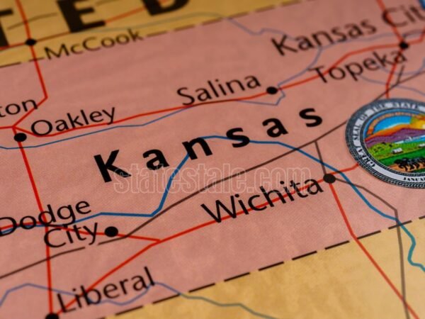
Kansas on the United States map: location, facts, and resources
Spread the loveKansas in central United States, the ‘Sunflower State’. It’s bordered by Nebras...
US map of the states and capitals
Spread the loveHere's the complete table of all 50 U.S. states, including capitals, 2024 population ...